THE LOCATION OF PANCEVO
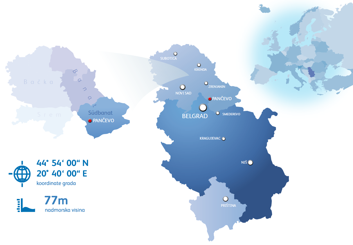
In the south of Vojvodina, at the confluence of the Tamis River and the Danube, only 18 km from the capital of Serbia-Belgrade is the city of Pancevo, economic, cultural and administrative center of the South Banat District.
Municipalities with which the Pancevo borders are Kovačica, Alibunar, Kovin and Capital Belgrade, as well as the southern border of the Danube (according to the Belgrade municipality Grocka).
Position of Pancevo in Vojvodina, Serbia, Europe
 It is located in the immediate vicinity of Corridor 10 (Salzburg-Ljubljana-Zagreb-Belgrade-Nis-Skopje-Thessaloniki), with branches from Belgrade to Horgos and from Nis to Dimitrovgrad.
Corridor 7 (Danube transversal) which directly connects Pancevo with central and southeastern Europe. This corridor is the lifeline of river traffic Europe and navigable part of the basin (North Sea-Rhine-Main-Danube-Black Sea-further to the east).
Distance from borders
Hungary 214 km
Croatia 137 km
Romania 160 km
Bulgaria 300 km
B&H 185 km
Distance from highway
E – 75 18 km
E – 70 0 km
Distance from airport
BELGRADE 40 km
Pancevo has a port on the Danube and two piers.
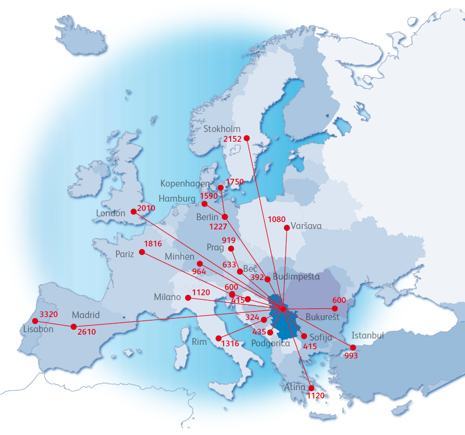
Pancevo distance from major cities in Europe:


